At the Dig Safe North Idaho 811 notification center, customer service representative (CSR)s use a map to identify the excavation area. PRISM can incorporate a wide variety of geo-coded layers to permit using a number of different points as reference: mile post markers, parcel boundaries, etc. CSRs can also access publicly available mapping systems (Google Maps®, Bing®, Yahoo®, etc.) on the fly if the location can’t be matched with the center’s basemap.
Excavation Area
The excavation area is the full extent of the actual dig site. PRISM identifies the dig site based on a hand-drawn polygon created at the time of the ticket submission. PRISM can also use regularly shaped grids to identify the notification area if notification center chooses.
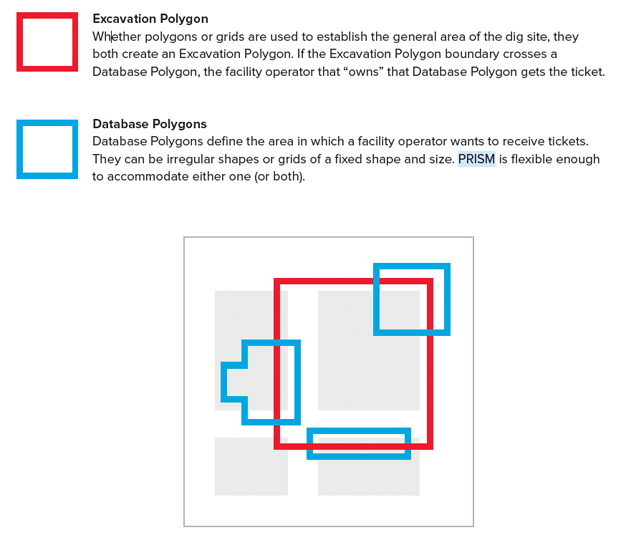
Excavation Polygon
Whether polygons or grids are used to establish the general area of the dig site, they both create an Excavation Polygon. If the Excavation Polygon boundary crosses a Database Polygon, the facility owner that “owns” that Database Polygon gets the ticket.
Database Polygons
Database Polygons define the area in which a facility owner wants to receive tickets. They can be irregular shapes or grids of a fixed shape and size. PRISM is flexible enough to accommodate either one or both.